
City guide
Saint-Brieuc
Use the places and landmarks in this guide to plan visits at your own pace.
Read the guide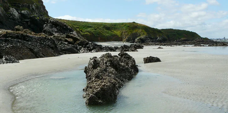
What to discover
Places to visit in Saint-Brieuc
Saint-Brieuc sits between a historic Breton centre and a coast shaped by rock, tides and the Gouët estuary. The old town can be explored on foot around the cathedral, while the bay opens onto reserves, headlands and smaller coves. Inland, the river passes through a landscape of weathered boulders and woodland.
The old town and cathedral
Much of the old town grew around the Cathédrale Saint-Étienne in the fifteenth and sixteenth centuries. Its largely pedestrian lanes retain cobbles, narrow passages and a number of timber-framed houses. Among them are the Hôtel dit des Ducs de Bretagne, dated 1572, and the sixteenth-century Maison de la Barrière and Maison Le Ribault. The Fontaine Saint-Brieuc marks the site of the monastery associated with the city’s foundation in 580.
Construction of the cathedral began in the thirteenth century. Conflict, damage and rebuilding left several periods visible in the fabric, including work carried out during the fourteenth-century War of the Breton Succession. The south transept contains a rose window whose coloured light is most apparent when direct sun reaches it.
The Musée d’Art et d’Histoire provides a broader account of the area. Its collections concern local archaeology and popular traditions, including maritime life, agriculture, textiles, crafts and religion. Objects trace these activities from the city’s early history into the first decades of the twentieth century, while a separate space is used for temporary exhibitions.
The bay and the Gouët estuary
The Réserve naturelle de la baie de Saint-Brieuc is divided between the Anse d’Yffiniac and Anse de Morieux. Its paths pass salt meadows and dune systems used by many species of birds, as well as plant habitats that include rare and protected species. Cliffs along the reserve’s edge give a higher view across the intertidal landscape.
Closer to the estuary, the ruined Tour de Cesson occupies a rocky spur above the bay and the Gouët. Built in 1395 on a strategic defensive site, the tower was used at different times as a residence and a prison. Its importance also made it a target, and local inhabitants ordered its destruction in the seventeenth century. The surviving structure later became a landmark for sailors.
North-east of the city, Anse de la Vierge is a small beach near the mouth of the estuary. Above it, the wooded path of Anse aux Moines follows the coast from one cove to the next. The route looks back across the estuary and provides a quieter, close-range view of the shoreline than the larger headlands farther around the bay.
The boulder landscape of the Gouët
About ten kilometres inland from Saint-Brieuc, the Chaos du Gouët is a classified natural site in the river valley. Here, erosion has rounded and piled large rocks in the bed of the Gouët. Moss covers many of the boulders, and the river breaks into small falls as it moves between them. The setting brings together the same elements of stone and water found on the coast, but within a sheltered, wooded corridor.
Headlands around the bay
Pointe du Roselier rises 68 metres above the bay. The headland was once part of the coastal defence against English attack, and a marked path descends towards the remains of a cannonball furnace dating from the seventeenth or eighteenth century. The upper ground overlooks the cliffs, the bay and its approaches.
Farther east, Cap Fréhel closes the bay with high pink-sandstone cliffs exposed to the sea. A coastal path reaches the lighthouse, which has been rebuilt several times, and runs through an open landscape of rock, wind and sea. In clear weather, the view extends towards Jersey in the Channel Islands. The cape gives a wide geographical context to the coves, estuary and reserve closer to Saint-Brieuc.
Keep exploring
More guides from the same area to help you continue your search.