
Pyrénées National Park
Pyrénées National Park follows more than 100 kilometres of high country in southern France, from the Aspe valley in the west to the Aure valley in the east. Shared by the Hautes-Pyrénées and Pyrénées-Atlantiques departments, it is an unusually long, narrow park. Its scenery is shaped by Atlantic weather, sharp changes in altitude and a chain of valleys with distinct histories.
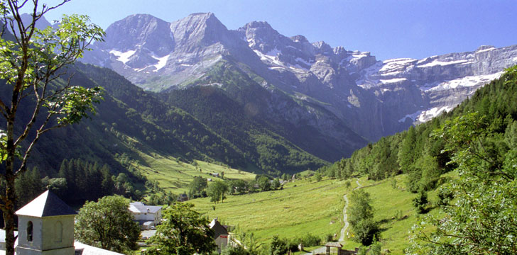
A narrow band of high mountains
The national park was created in 1967. Its central zone covers about 450 km² and has no permanent inhabitants. Although the park extends for a considerable distance, its width ranges from only 800 metres to 10 kilometres. The protected core stays above 1,000 metres, reaching 3,298 metres at Vignemale, its highest summit.
Proximity to the Atlantic gives the mountains a generally mild, wet oceanic climate, modified locally by elevation and the direction of each slope. Rainfall is heaviest in the west and decreases towards the east. These differences also shape the vegetation. Beech and fir favour cool, damp north-facing mountain slopes, while pines occur on southern aspects. Higher up come open stands of mountain pine, birch and rowan, followed by low alpine plants, dwarf willow, lichens and algae.
Valleys with different landmarks
Luz-Gavarnie is known for the Cirque de Gavarnie, a vast limestone formation cut by water. Some of its walls rise to 1,500 metres, and a waterfall drops more than 420 metres. In the Cauterets valley, water again defines the landscape through mountain lakes and streams. Lac de Gaube is one of its best-known lakes. Pont d’Espagne stands where the gave du Gaube and gave du Marcadau meet, on an old route that once led towards Spain.
The Aspe valley carries a different record of movement through the mountains. Pilgrims travelling to Santiago de Compostela passed this way. Under Louis XV, workers cut the Chemin de la Mâture for more than a kilometre into the cliff so that timber could be taken down the valley for shipbuilding, particularly for masts. It is now used as a walking route. In the Ossau valley, the volcanic Pic du Midi d’Ossau dominates a landscape still associated with seasonal livestock movement to summer pasture.
Lakes, animals and working landscapes
High-altitude lakes are spread across the park. Orédon lies in the Aure valley near the Néouvielle reserve and below Lac de Cap-de-Long. Gaube and Oule are other prominent waters, while some lakes and altered valleys record the development of hydroelectric power. Val d’Azun remains agricultural lower down, with hydroelectric installations farther upstream.
The isard, a mountain-dwelling relative of the chamois, is the park’s emblematic animal. Golden eagles and griffon vultures range over the valleys. Marmots, introduced from the Alps, are also present, as are genets and a large variety of butterflies. That diversity follows the park’s succession of forest, subalpine woodland, short alpine vegetation and bare high ground.
Visiting with the mountain environment in mind
The park was founded to protect animals and the places on which they depend. Pastoral traditions, old transport routes and hydroelectric works have also shaped its valleys. Taking one valley at a time makes those differences easier to see.
Conditions can vary sharply between the wetter west, the more sheltered east and the high summits. Before a walk, visitors should consult current forecasts and local park information rather than rely on conditions lower in the valley. Wildlife should be watched without disturbance, and the same care applies to high lakes, pasture and other sensitive habitats.