
Vanoise National Park
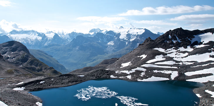
Vanoise National Park protects a high Alpine landscape in Savoie, beside the Italian border. The Isère and Tarentaise valleys lie to the north of the massif; the Arc and Maurienne are to the south. Across the frontier, the park meets Italy's Gran Paradiso National Park, creating a continuous protected mountain area between the two countries.
France's first national park
Vanoise was created in 1963 as France's first national park. Protecting the Alpine ibex was central to its foundation: hunting had eliminated the animal from the French massif, while a small population survived across the border in Italy. Proposals for a French park had been discussed from 1943, but it took another two decades to settle its boundaries and establish protection for the area's animals, plants and geology.
The ibex has since returned to the Vanoise. Chamois also live on its slopes, along with red foxes, badgers, stone martens and stoats. Golden eagles patrol the high ground, while owls and smaller birds occupy lower habitats. Frogs and toads occur alongside reptiles including grass snakes, lizards and vipers.
Valleys, summits and plant zones
More than a hundred summits in the massif rise above 3,000 metres. The highest is the Grande Casse at 3,855 metres, followed among the principal peaks by Mont Pourri, the Dent Parrachée and the Dôme de l'Arpont. Broad pastoral valleys, mountain lakes and high passes break up the rock and ice. The Tarentaise follows the upper Isère towards Albertville, while the Maurienne runs along the Arc for about 120 kilometres.
Plant life changes markedly with altitude and exposure. Above 3,000 metres, ice and prolonged snow leave little beyond lichens. Between roughly 2,000 and 3,000 metres, scattered alpine plants include soldanella, edelweiss and dwarf willow. Rhododendron heath, larch, spruce and pine occur in the subalpine belt. Lower down, beech and pine grow in the mountain zone. Deep valleys create local differences in sunlight, cloud and precipitation, so two slopes at a similar height can have quite different conditions.
The protected core
The park's central core covers about 530 square kilometres of alpine pasture, glaciers, rock and forest. It is more strictly regulated than the surrounding area. Hunting is prohibited, while public access, collecting mushrooms, carrying out works and introducing plants or animals are controlled or banned. Blue, white and red markers indicate the boundary of this protected zone.
Outside the core, neighbouring communes can take part in a charter intended to combine protection with local development. Several nature reserves add protection in areas affected by ski development. These include Tignes-Champagny, an ibex migration corridor; Grande Sassière, noted for its plant life; Plan de Tuéda, with an extensive pine woodland; and Villaroger, where ibex and black grouse occur.
Walking and responsible access
Summer walking routes reach the pastoral valleys, lakes and cols, and mountain refuges support longer journeys. The GR5 and GR55 are among the long-distance paths crossing the massif. In winter, activity is concentrated around the ski areas of the surrounding Tarentaise and Maurienne valleys rather than the most tightly protected parts of the core.
Visitors should use marked routes and observe the rules posted at the core boundary. Do not approach ibex or other wildlife for photographs, collect plants or disturb rocky nesting sites. High altitude, snow cover and the contrast between shaded and sunny valleys can change conditions quickly, so route choice should match the season and the walker’s experience.