
Narbonnaise en Méditerranée Regional Nature Park
Close to Narbonne in the Aude department, this regional nature park brings together Mediterranean lagoons, coastal dunes and the dry hills of the Corbières. Its character comes from the sharp transition between wetland and limestone country, with vineyards, villages and historic routes threaded through the natural habitats.
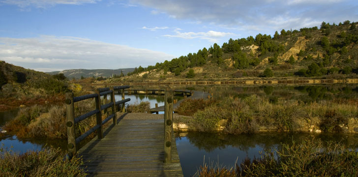
Between the Corbières and the coast
The Narbonnaise landscape changes over short distances. The maritime Corbières rise to the west, with rocky massifs, dry plateaux, shallow valleys and low garrigue. Aleppo pine grows on some wooded hills, while alluvial plains and foothills lead towards the coast. Around Fontfroide, vineyards share the hills with medieval castles and small mills; elsewhere, vines occupy sheltered ground on the valley floors.
Nearer the Mediterranean, ponds, salt marshes and lagoons interrupt long sandy strips. The main lagoons include Ayrolle, Gruissan and La Palme. A narrow coastal barrier, known as a lido, separates their brackish and salt water from the open sea. These are places where marine and freshwater life overlap, but they are also working landscapes shaped by fishing and salt production.
Habitats and wildlife
More than fifty types of natural habitat are described within the park. Amphibians, dragonflies, snakes and lizards live around its ponds, alongside many kinds of fish. Garrigue supports aromatic plants such as rosemary and jasmine, while holm oak, pine, juniper and strawberry tree grow in the more wooded Corbières. On the shore, vegetation is sparse at the water's edge. Sea lilies and marram grass appear behind the beach and become denser on older dunes.
Bird movement gives the coast a strong seasonal rhythm. From autumn into early spring, birds arriving from Arctic regions feed on shoreline invertebrates. Terns seek nesting sites in April, and larks use sheltered parts of the dunes. Eagles and warblers occur farther inland in the garrigue. The lagoons and surrounding marshes provide feeding and resting ground beside areas used by fishers and salt workers.
A long-settled landscape
Plans for a regional nature park developed in the 1990s, when attention turned to protecting the lower Aude valley and the massifs around it. The project was entrusted to the Mediterranean Environment Agency under a regional mandate, and the park was established about a decade later. Its organisation brought together representatives of 27 communes, trade bodies and local associations.
Human history is particularly visible in the foothill belt between the lagoons and the Corbières. The Via Domitia, the Roman road that linked Italy and Spain, crosses this area. Other landmarks include the early Christian cemetery of Saint-Paul-Serge, the medieval castles of Fitou and Montséret, and Fontfroide Abbey, where the surviving Romanesque fabric recalls its Cistercian past.
Exploring responsibly
The most sensitive areas are also the easiest to disturb. Dunes shelter nesting birds, and marsh edges are both wildlife habitat and places of work. Follow local signs, avoid cutting across dune vegetation and watch feeding or nesting birds from a distance. In the dry hills, the shift to vineyards, woodland and village land is often sudden, so authorised paths are the soundest way to explore the Corbières without straying onto working ground.