
Verdon Regional Nature Park
Verdon Regional Nature Park covers about 188,000 hectares across Alpes-de-Haute-Provence and Var, in the Provence-Alpes-Côte d’Azur region. The Verdon runs through it for 175 kilometres, linking high country and wooded hills with deep gorges, broad plateaux and a series of lakes.
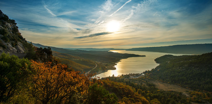
The area became a regional nature park in 1997. Its charter places nature protection alongside sustainable development, an approach suited to a territory where villages, farms, forests and popular recreation areas all share the same river system.
The river and its gorges
Over millennia, the Verdon cut down through the rock to form narrow gorges between abrupt cliffs. The green river below, footpaths on the slopes and the Route des Crêtes above reveal the gorge at very different levels. Water-based activities also take place along parts of the river, though access and conditions need to be checked locally.
The park holds evidence of a much longer human presence. Prehistoric and Roman remains are found alongside medieval churches, castles and fortified country houses. In the lower Verdon, Sainte-Maxime cave is one of the places associated with early settlement. Trout and pike inhabit the calmer waters of the lakes in this part of the park.
Lakes, plateaux and working country
Dams built along the Verdon during the twentieth century created several large artificial lakes. Lac de Sainte-Croix dates from the construction of its dam at the entrance to the gorges in 1974. Covering around 2,000 hectares, it submerged former villages and later became a centre for lakeside holidays and water activities.
East of the main gorge country, the Artuby flows through upland valleys and hills towards Mont Lachens. Small villages sit among land used for livestock and market gardening. The wooded hills of the Haut Var combine cultivated ground with areas associated with vines and truffles.
The Plateau de Valensole has a different scale and appearance. Its 800 square kilometres of fertile alluvial soil support cereals and lavandin, with almond trees also present. Archaeological remains show that people occupied the plateau in prehistoric times. These cultivated expanses form a marked contrast with the enclosed river valleys and mountain massifs elsewhere in the park.
Wildlife across two climate zones
Mediterranean and Alpine influences meet within the Verdon, allowing plants and animals with different requirements to live relatively close together. Griffon vultures, bearded vultures and golden eagles can be seen around the gorges and higher relief. Black grouse occur on the ridges, while bats use habitats across the park. Dippers and kingfishers are associated with the riverbanks.
Among the larger mammals are roe deer, red deer, wild boar, chamois and marmots. Plant cover changes just as clearly with altitude and exposure. Olive trees, oaks, lavandin and lime trees occur in lower or more Mediterranean areas. Beech, Scots pine, larch, spruce and fir are found on mountain ground, while the gorge ecosystem supports uncommon ferns and bellflowers.
Exploring the Verdon responsibly
The park can be approached on foot, from the high road around the gorges or at designated lake and river sites. Each setting calls for different preparation. A walk above the gorge, a visit to a plateau village and time beside Lac de Sainte-Croix should not be treated as the same kind of outing.
Use established paths, keep a respectful distance from wildlife and follow restrictions around protected or managed sites. River levels, weather and seasonal access can affect both walking and water activities, so current local information should guide plans. In farmed areas, remain on the route provided and avoid damaging crops or disturbing livestock.