
Volcans d’Auvergne Regional Nature Park
Volcans d’Auvergne Regional Nature Park crosses the central Massif Central through Cantal and Puy-de-Dôme. Created in 1977, it extends for roughly 120 kilometres from north to south. Rather than forming a single volcanic field, the park brings together the Chaîne des Puys, Monts Dore, Cézallier and Cantal massif, as well as the granite plateau of Artense.
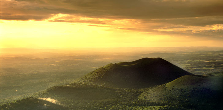
That range of landforms gives each part of the park a recognisable character. Rounded cones and domes lie alongside high plateaux, glacial hollows, peat bogs, lakes and deeply cut valleys. Farms, Romanesque churches and castles add a human record to terrain formed over a much longer timescale.
Artense and the Cézallier
Artense lies in the west-central Massif Central, straddling Cantal and Puy-de-Dôme. Unlike the volcanic areas around it, this is a granite plateau. Low hills and shallow basins hold numerous lakes, and the relatively modest altitude makes its wet mountain climate milder than that of some neighbouring uplands.
The Cézallier occupies the centre of the park. Much of this volcanic plateau lies between about 1,200 and 1,500 metres, with the Signal du Luguet reaching 1,551 metres. Domes and broad uplands are interrupted by traces of glaciation, including early cirque forms and peat bogs. Cooler northern ground supports firs, bilberries and heather, while the southern part has oaks and drier vegetation.
From the Cantal massif to the Chaîne des Puys
The Cantal massif is the remnant of an old volcano whose last eruption occurred more than two million years ago. Plomb du Cantal, its highest point, rises to just under 2,000 metres. Rain and unsettled conditions can persist even in summer. The valleys and upland pastures are also a cultural landscape, with Salers cattle linked to Cantal cheese production and a heritage of castles and Romanesque churches.
Farther north, the Chaîne des Puys lies west of Clermont-Ferrand. Its roughly eighty volcanic forms create a sequence of wooded cones and domes. The Monts Dore are older than this chain but reach higher: Puy de Sancy approaches 2,000 metres. Volcanic lakes, springs and spa towns are found across the massif, while paths and winter sports connect settlements with the high ground.
Nature reserves and mountain wildlife
Four reserves protect some of the park’s more fragile environments. The Vallée de Chaudefour has mountain wildlife and plants associated with Alpine conditions. Chastreix-Sancy includes steep, peaty plateaux, while the Sagnes de la Godivelle are shaped by abundant water. At Rocher de la Jaquette, dry grassland, heath and woodland support a varied insect population.
Wildlife changes with altitude and moisture. Otters and small dragonflies occur around the waterways of the Cézallier. Chamois, mouflon and marmots inhabit the more mountainous areas. The contrast between wet plateaux, forest, dry grassland and exposed slopes explains why a short journey through the park can cross several distinct habitats.
Exploring the volcanic uplands responsibly
Walking is the clearest way to read the shapes of the old volcanoes and glacial ground. It also brings visitors close to peat bogs and reserve habitats that are easily damaged. Remain on established routes, observe any restrictions within protected areas and avoid trampling wet ground or disturbing animals.
Mountain weather deserves equal attention. Conditions in the Cantal and around the higher summits can change even during summer, so route choice should reflect the forecast and the terrain. Current local guidance should be checked before setting out, particularly for reserve access, high-level walks and seasonal activities.